Definitely,
as the name suggests, the route has it all. You can pass by the subtle
differences in weather with a fine air of purity & nothing else, just the
forests. Starting at Mankarai, the forest check post chops the rest of the town from the scarcely
populated, tribal colony, Anaikatty. It is exactly where the ghat road begins.
Well, it isn’t a ghat road, but its presence parallel to two distinct hills
makes it appear so. The hills on the east connect to the Attappady reef and to
the west, it’s the Tholampalayam reef. There are numerous elephant corridors,
which you will travel across once you drive through the ghat road. The route
begins with the check post and then a lot of breathtaking views which you would
undoubtedly enjoy if you are a route analyst. I did enjoy the views and started
experimenting on them while on my tripping.
Once,
when I had trekked, I remember the road that took to a small tribal hamlet,
exactly behind the Salim Ali Center for Ornithology & Natural History,
which shortly is called SACON. It’s an access restricted road, that tears
through the dense forests, leading to a 2 km long rain forest area and finally
to the hamlet. Everybody there has a promising sight of the wonderful vaidehi
falls, because the colony is perched atop the hill. You descend 15 – 20 kms ,
there you are at Coimbatore’s Narasipuram. A really interesting data about the range
is that, the forest road is well within the borders of Tamil Nadu, but the hamlet
that ends the road falls in Kerala , so all we could take to reach there is a
Kerala jeep,..
Now
further heading straight thru the Anaikatty- kerala road, the stop that
attracts you first is the Goolikadavu,, giving a town like feeling amidst the
dry hills. Well before Goolikadavu, you will be able to find kottathara, pudhur
and sholayoor; the last one being the thickly forested. Sholayoor is again a
smaller place with not more than 500 houses,however there are lots of
deviations invited by the eastern stretch of hills. Also in the routes to
western side of the hill range, you find the hotspot, Mukkali, where the Silent
Valley National park is housed. Areas like Thavalam, Kalkandi & ommala are
located just in and around the forests. Far east from Attappady is Chittor ,
where the Singappara reserve or the forest station can be spotted. This is the
adjoining reef to the Siruvani range. Especially where Siruvani, bhavani and
smaller rivulets converge. The river that diverts itself right at the western
side, at attappady is the Kunthipuzha flowing gracefully uphill to reach
Ummathampady- mulli reef and finally Kinnakkorai, a
small village of magnificient beauty, where only tea estates and rain forests encircle
it with nothing except forests and green vegetation grabbing vivid range of
visibility . Many claim this the
origin of the badaga community, nevertheless controversies exist . U will also
have a divergence to reach Kundah dam. The Mother road from Goolikadavu heads
straight to the hairpin bends, which passby the parts of the reserve, east of
which a beautiful cascade can be spotted. With lush greenery and dangerous
invertebrates, basically the Leech and russel’s viper, it’s a road that’s quite
scary.
There is a Malabar bus service and the ever existing Jeeps bearing KL 10 registrations, tearing down to the
greenish hillocks, you get to see the smaller hamlets here and there. You don’t
really find sunlight in the hairpin bends until u are at the forest check post
at Mukkali. The ghat roads terminate here and then you start feeling the hot
weather of Thenkara – Mannarkad – either the Palakkad road ( goes east to
Kanjirappuzha, MUndur )– or the Malappuram road ( goes west to perinthalmanna –
Manjeri & Calicut). People from Kerala, whilst tripping to ooty, take the
Malappuram – Chokkad – Vazhikkadavu road that stops at Munderi, within limits
of Wayanad and then goes to Gudalur by crossing the Tamil nadu border. The road
sweeps through the awe inspiring silent Valley National Park (main) being the
Upper Bhavani area. It is just an excellently paved road , with just green
vegetation & nested hills until clear visibility. You will find nothing
else.
Try
these routes, they aren’t so dangerous except for the elephant corridors, you
will certainly enjoy tripping
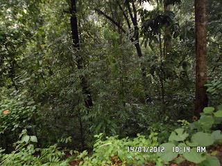
These are some of my Clicks
Windmills at Sholayoor
Hut
from a view point
Exotic
flowers on the hill roads
Roads
near Mukkali
The house again
Attappady


This comment has been removed by the author.
ReplyDelete